R Roosevelt Island Historical Society

Walk the island

27 stops. Two routes. Four centuries.

Start at the Visitor Center kiosk and choose the south or north route. Each route is ordered for walking, with the next stop linked at the end of every entry.

The original RIHS route map, with the south route in red and north route in blue
The original high-resolution route map, recovered from the 2014 tour.

Self-guided route

South Roosevelt Island

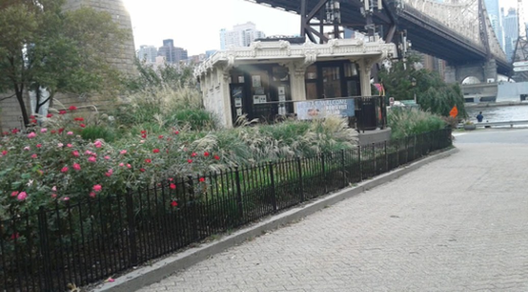
Historical tour image: Visitor's Kiosk

South route · stop 1

Visitor's Kiosk

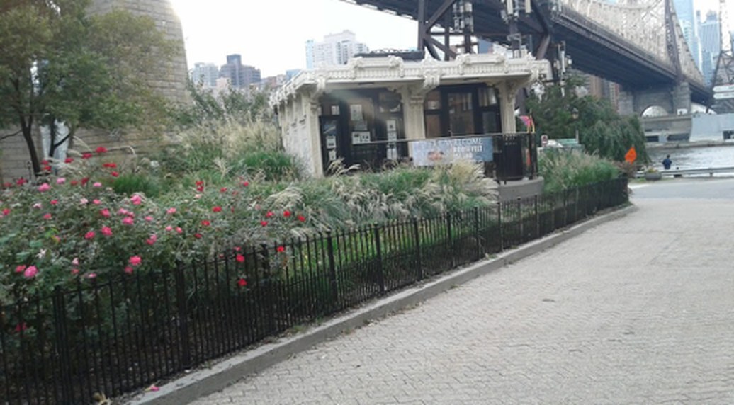
Welcome to Roosevelt Island! Or should we say, Welcome to Minnahannock! Or maybe, Welcome to Hog Island! No? How about Manning? Blackwell? Welfare? As you can see, Roosevelt Island has a colorful history, which is represented most clearly in its many names.

The island’s first name was given by members of the Canarsie tribe, a group of indigenous people related to the Pequots of New England, and who lived primarily on the western half of Long Island. The natives used the island as a hunting ground and when Dutch Governor Wouter Van Twiller purchased the island in 1637, he used it for much the same purpose: raising pigs. Hence the name Varkens Eiland, which is Dutch for Hog Island.

Less than 20 years later, in 1665, British Captain John Manning seized the island from the Dutch in a battle for control of New Netherlands. He (selflessly) named the island after himself, and built himself a large comfortable plantation house, which would be his only comfort after he surrendered Fort James (Fort Amsterdam) during a Dutch attack on August 9th, 1673. For his cowardice, Manning was sentenced to death, only to receive a pardon in exchange for a humiliating public dismissal at City Hall, which included having his sword broken in two. He retired to his island in drunken exile in 1675, where the local reverend recalled, “I have been several times with the said Captain whose [nightly] entertainment was commonly a bowl of rum-punch."

In 1686, Manning’s daughter and son-in-law, Robert Blackwell, became the owners of the island and changed its name to reflect the change of ownership. In 1796, Jacob Blackwell, Robert’s great-grandson, built what became known as the Blackwell House, which can be seen on the North Tour.

The island remained in the Blackwell family until 1828, when the City of New York purchased the island from a Blackwell descendant for $32,500 ($678,847.09 in today's money - a steal for such prime real estate in New York City!).

Over the next century, many institutions were built on the island, such as a penitentiary and a large number of hospitals, some of which still exist on the island.

In 1921, the city changed the name of Blackwell Island to Welfare Island, in an attempt to give it a better reputation. Two hospitals were also built as part of this endeavor. The island’s name remained the same until 1973, when its name was changed yet again, this time to Roosevelt Island, in honor of President Franklin D. Roosevelt. Given its history, who knows what we will be calling it next week!

Your next stop depends on how much time you have. The path to the north is longer, and takes you past the Blackwell House mentioned earlier, as well as a variety of interesting stops, including a monstrous car garage and a lighthouse rumored to have been built by a patient of the insane asylum.

To the south is a slightly shorter tour that focuses on the island's southern half and it's rapidly changing history. You can also see the newest addition to the island: a memorial dedicated to its namesake. If you have plenty of time, or just can't get enough of this amazing island, why not take the south tour, and then continue through to the North Tour. The choice is up to you, but most of all, have fun and enjoy Roosevelt Island!

If you have any questions, feel free to go into the Visitor’s Kiosk. They would be more than happy to answer any questions you may have.
Historical tour image: Tram Station

South route · stop 2

Tram Station

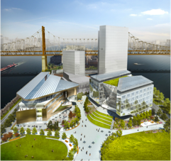
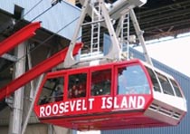
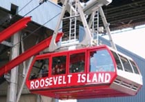
What IS that? Or, for those of you who just got off it, what in the world was I riding on? No, we're not going skiing. Those red floating cars are part of the Roosevelt Island Tramway, known to Islanders simply as the Tram, which, from 1976 until 1989, was the only direct way to get to Roosevelt Island from Manhattan. Designed by Prentice, Chan & Olhaulsen and built by Swiss company Van Roll, the Tram was modeled after ski lifts that carry passengers up a mountain in a fraction of the time a conventional method would take. The tram is also unique as being the oldest tram system in North America, and is currently one of only 2 aerial tramway systems in operation in the United States. With an average ride time of three minutes, delivering Islanders to Second Avenue at 60th Street, the Tram's speed helped advertise housing on the island with the campaign "from home to Bloomingdales in 3 minutes."

If you have a fear of heights, don't look down: the Tram carries passengers 250 feet above the East River. But don't worry, the spectacular view of Manhattan's East Side will keep your attention away from the ground. The Tram makes over 115 trips a day, so anytime is a good time to hop on and see what Islanders campaigned to save after the subway arrived in 1989.

Even if you've never ridden the Tram, it might look familiar to comic book fans: 2002's Spiderman saw the Green Goblin force Spider-Man to choose between saving a Tram full of passengers or his love, Mary Jane. Although the scene was crucial to the film's climax, it caused the Tram to be out of service for weeks, leaving the F-Train as the only route to Manhattan. Thankfully the Roosevelt Island Subway Station is just as interesting as the Tram!

Historical tour image: Goldwater

South route · stop 3

Goldwater

Although hard to see through the tall construction fence, Goldwater Memorial Hospital currently sits on this 9.9 acre site, but is in the process of being demolished. Why? Well, we'll see in a few stops.

The Welfare Island Hospital for Chronic Disease was constructed from 1935 to 1939 and designed by Isadore Rosenfield, Butler & Kohn, and York & Sawyer. This was the hospital's name until 1942 when it was named for Dr. S. S. Goldwater, who had campaigned so hard for an advanced hospital complex. It was designed to be a cutting edge technological campus not only care for patients with debilitating diseases, but work toward cures at the same time. Using intensive sun studies, Rosenfield discovered that chevron-shaped wards with beds parallel to the exterior walls on a vertical spine created a hospital full of light and accessibility.

During World War II, the basement of Goldwater was used as a secret laboratory working on a cure for malaria and other diseases American forces were battling overseas. Conscientious objectors volunteered as guinea pigs for tests on hypothermia, dehydration, and other afflictions.

In 1996, Goldwater merged with Bird S. Coler Memorial Hospital on the north end of the island, becoming Coler-Goldwater Memorial Hospital. In 2010, it was announced that the campus would close, and patients relocated to the Coler campus and a new center in Harlem. On December 31, 2013, the campus was officially shuttered, and the demolition began at the end of January 2014. Preliminary demolition is slated to be finished January 2015.

Photographer and architect Charles Giraudet has been furiously documenting Goldwater Hospital in its last days, compiling an extraordinary 15,000 images so far during the brief window between its de-commissioning and its imminent demolition. Learn more about his work HERE .

What is going to take Goldwater Hospital’s place after it’s taken away in the multitude of dumpsters on the right? Continue the tour to find out!

Historical tour image: Penitentiary

South route · stop 4

Penitentiary

Look to your right: WOW. That is a million dollar view of Midtown Manhattan, likely a multi-million dollar view. At this exact spot, on a clear day, it's possible to see the Chrysler Building, the Empire State Building, the United Nations Complex, and One World Trade Center all at once. We're sure we don’t to need to remind you, but this is one amazing photo opportunity. With a view like this, you may never want to leave...

However, when the people lived on Blackwell's Island 175 years ago, leaving wasn't an option. On this site in 1832, just 4 years after the city purchased the island from the residing Blackwell family, Blackwell's Island Penitentiary was opened to house some of New York City's most notorious criminals. Acting as one of two official state prisons (the other was and still is in Albany), the penitentiary grew to become a complex housing not only criminals, but also workhouses, which were built in 1852 and meant to punish petty violators with intense labor.

Like many of the stone structures on the island, the penitentiary was built of gneiss both quarried on the island, and erected by the prisoners themselves; although we doubt they were happy about building their own cells. The main penitentiary building was 600 feet long and 4 stories tall with an additional wing on the north side, resembling a medieval fortress. It had 800 cells and housed about 1,000 inmates (sorry if you didn't want a roommate, this is New York after all). The workhouses were also built of gneiss by inmates, was 3 stories tall, and had room for 221 inmates.

By the end of the century, the prison had become corrupt, and several celebrities, including politician Boss Tweed and actress Mae West . By the 1930s, corruption was so rampant that the Department of Corrections closed Blackwell's Penitentiary and moved all the inmates to a new facility on Riker's Island.

It's hard to imagine that something like this existed on such a small island. If you don't believe us, check out photos from the New York Public Library HERE .

Historical tour image: City Hospital

South route · stop 5

City Hospital

Welcome to Southpoint Park! Quite hilly, no? Is there gold in those hills? Not quite, but there is plenty of gneiss and no, it's not all bedrock and didn’t start in these hills.

Underneath the tallest hill is all that remains of City Hospital, which was built on this site in 1832. Well, that's not entirely true. What rests below the park is the second city hospital designed by famed architect James Renwick, Jr. in 1858, and completed in 1861. The hospital changed its name to Charity Hospital in 1870, and the Island's name was changed in 1921 to Welfare Island to reflect the work that the hospital and other institutions were doing.

In 1957, the hospital moved to Queens, and the building was shuttered. In 1970, the Second Empire style building was selected by preservation architect Georgio Cavaglieri to be one of the 6 buildings preserved on the island under an Urban Development Corporation plan by Philip Johnson and John Burgee in 1969. It was even nominated to the National Register of Historic Places in 1972.

Sadly, national recognition is not enough to protect a building. In 1994, after years of neglect, Charity Hospital was demolished. The only way to see Renwick's masterpiece now is through the amazing collection at the NYPL . You can see remnants of the hospital’s stone throughout Southpoint Park, in the low walls around many of the hills. Find other parts of the building by looking for shaped stones throughout the park

City Hospital wasn't the only Renwick building on the island. He also designed the next stop on our tour, as well as the lighthouse at the northern end of the island. You should compare his work and visit both stops!

Historical tour image: Smallpox Ruin

South route · stop 6

Smallpox Ruin

On cloudy days, this facade can seem like something out of a horror movie. Although not quite a horror movie, this landmark was in an action movie, Spiderman in 2002. This gothic revival building was designed in 1856 by our good friend, James Renwick, Jr., as the first hospital in the United States to treat victims of contagion and plague. It was the only hospital in New York to accept patients with smallpox and it was the only hospital on the island to accept paying clients, while the others were devoted strictly to charity.

The building was constructed of, you guessed it, island gneiss and used inmate labor, which was so cheap that the cost of construction was only $38,000 ($158,000 in today's money). It is three stories tall with a central tower and two flanking wings, added in 1902 and 1905.

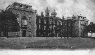
In 1875, the hospital's name was changed to Riverside Hospital (there's an awful lot of name changing going on here, don't you think?), and 11 years later, the patients were transferred to the new Riverside Hospital on North Brother Island. The building was then used as a nurses's residence for neighboring City Hospital, but, as we saw earlier, Charity Hospital moved to Queens in 1957 and the hospital was, sadly, abandoned.

In 1970, our preservation architect Georgio Cavaglieri selected the Smallpox Hospital to be one of 6 buildings to be preserved on the island. Interestingly, Cavaglieri wanted to preserve the hospital as a ruin, which it was landmarked as in 1976, the only one in New York City. Someone, however (we're looking at you, Cavaglieri) did not anticipate how quickly the salt air and heavy winds that pass over the island would affect the ruin. Today, the ruin is being supported by a series of internal and external scaffolding and is surrounded by a fence, preventing the public from getting too close. The only inhabitants of the ruin now are migrating geese and the island's cat population, who can be seen (if you're lucky) laying in the hospital's windows.

Check out the Hospital's Designation report HERE to see how special this ruin really is. The hospital still requires stabilization efforts. If you are interested in helping out, contact the Roosevelt Island Historical Society .

Historical tour image: Four Freedoms Park

South route · stop 7

Four Freedoms Park

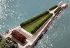
They say you can't rush art. Well, no one rushed Louis Kahn, whose Franklin Delano Roosevelt Memorial took 37 years to be realized.

Based on President Roosevelt's State of the Union Address on January 6, 1941, the monument was designed by famed modernist architect Luis Kahn in 1972, and is the only Kahn work in New York City.

Sadly, Kahn died in 1974, and never saw his design built. Admirers of his work and of President Roosevelt campaigned to have the monument built and by 2005, had collected over $50 million. The memorial was dedicated as FDR Four Freedoms Park on October 17, 2012, and officially opened as a New York State park on October 24th. The park is almost entirely landfill, much of which came from the demolition of City Hospital

The memorial is free to visit, but a $5.00 donation is suggested. To learn more about the memorial, check out their website and a different great digital resource here . Venture up the stairs and down to the end of the memorial for a fantastic few of Manhattan and a stunning and very quiet room meant for reflection.

Now that we've seen the newest edition on the island, let's take a look at an older building that's been given new life!

Historical tour image: Strecker Lab

South route · stop 8

Strecker Lab

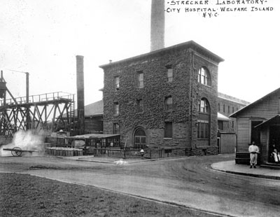
Situated on the eastern end of Southpoint Park sits Strecker Lab, once part of the City Hospital complex, now the last remnant. Opened in 1892 and designed by English Architect Frederick Clarke Withers (the same Withers who designed the Chapel of the Good Shepherd on Main Street) and Walter Dickson, Strecker is named for the Strecker family, who funded the construction of the original two story building.

In 1905, a third floor addition was designed by William Flanagan. Designed in the Romanesque revival style, the laboratory was the first in the United States devoted to pathological and bacteriological research. The first floor contained an examination room, and autopsy room and a morgue (the Smallpox Hospital doesn't look so creepy now, does it?). The top two floors were devoted to research and housed a library and a museum, that we're assuming was a very creepy one.

In 1907, the laboratory became part of the Russell Sage Institute of Technology, which was later absorbed by Rockefeller University. When the university moved, the lab continued work until the 1950s, when, like Charity and Smallpox Hospitals, it was abandoned in 1958.

The lab was not selected by Georgio Cavaglieri to be one of buildings to be preserved in 1970s, but it was made a New York City Landmark in 1976. However, Strecker remained in ruin, until 1999, when the Metropolitan Transit Authority began restoring the building to house the operations of the 53rd Street subway vent. As you can see, the exterior of Strecker has been beautifully restored, although its interior has been gutted. Talk about ironic.

Check out the designation report from Strecker to see how equally fantastic and creepy the laboratory really is.

Historical tour image: Promenade/Ferry

South route · stop 9

Promenade/Ferry

For those who say the Queens waterfront isn't as interesting as the Manhattan side, tell that to the Pepsi sign. Originally on top of the soda giant's Long Island City plant, the sign was removed when the plant closed in 1999. But rather than scrap the iconic illuminated sign, PepsiCo sold 21 acres to Rockrose Development Corporation in 2001, while keeping a 60 by 200 foot parcel for its sign directly on the waterfront. It’s now one of the most identifiable landmarks in Queens.

The waterfront is more than just a pretty spot to look out from. For centuries, it served as the only entrance to and from the island. Ferry service has been a part of the island's history since once left twice daily from 23rd street, carrying prisoners to their new home on Blackwell's Island. A plan was designed to reintroduce a ferry service in the Johnson Burgee plan of 1969, but it never materialized.

A new influx of residents, however, many finally bring the ferry back to the island. Where are these residents going to live? You're about to find out...

Historical tour image: Cornell Tech

South route · stop 10

Cornell Tech

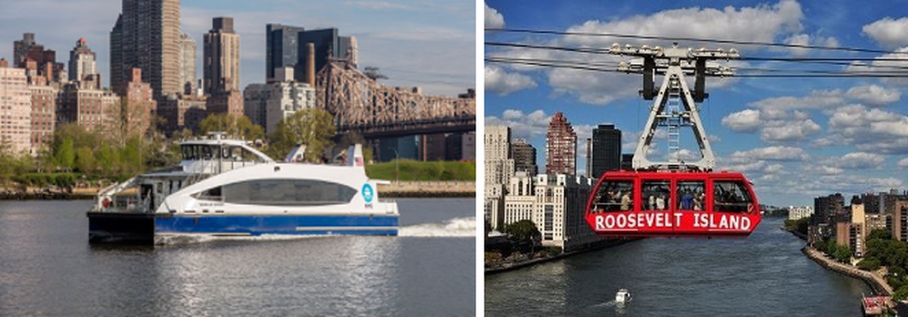
This construction fence is concealing the demise of Goldwater campus, but it is also the new home of Cornell NYC Tech, a new division of the university in partnership with Technion, the Israel Institute of Technology. As a part of Mayor Bloomberg’s 2011 initiative, Cornell Tech was awarded a 99-year lease to the 12.5 acre parcel of land, south of the Queensboro Bridge, and $100 million in city capital for site maintenance and construction.

Described as "a graduate school like no other," NYC tech will be a green campus, designed by Skidmore, Owings & Merrill and James Corner is doing landscape design. The new campus will include up to 2.1 million square feet of development and will house approximately 2,000 students and 280 faculty members by 2037. The institution is building a modern, sustainable campus full of glass towers meant to house a think-tank of businesses and graduate students, similar to Silicon Valley. The first phase of construction is expected to be completed in 2017. Until then, students and staff are operating out of Google’s Manhattan offices on 8th Avenue.

The construction of the campus has been met with mixed results, with some residents worried about infrastructure issues, while others see the campus community as an opportunity to revitalize the island.

Check out NYC Tech's website and see what they have to say.

Historical tour image: Queensboro Bridge

South route · stop 11

Queensboro Bridge

Standing underneath its massive eastern footing, it's hard not to feel like an ant. The Queensboro Bridge, officially titled the Ed Koch Queensboro Bridge and is colloquially known as the 59th Street Bridge. Designed by Gustav Lindenthal, Leffert L. Buck and Henry Hornbostel, designers of the Williamsburg Bridge, the Queensboro Bridge was constructed between 1903 and 1909 and cost $18 million and the lives of 50 men. It opened to vehicle and trolley traffic on June 12, 1909, when it was known as Blackwell's Island Bridge. Between 1930 and 1955, an elevator allowed vehicles and pedestrians to exit at Welfare Island, which is pretty convenient if you ask us. The trolley that ran across the bridge was decommissioned on April 7, 1957, the last trolley line in New York City.

The bridge was added to the National Register of Historic Places on December 20, 1978. If you look across the East River, to the right of the pier is the Terra Cotta House , the head quarters of the now-defunct New York Architectural Terra-Cotta Works. Constructed almost entirely out of terra-cotta, the house was made to be a showcase of the company's products.

To the immediate left of the house is the Silvercup Studios sign, a symbol of the largest film and television production facility in New York City. Operating out of the old Silvercup Bakery building the company is responsible for shows as diverse as 30 Rock, Mad Men, The Sopranos, and Gossip Girl, and films such as Julie & Julia, The Devil Wears Prada, Highlander, and The Gangs of New York.

A Pepsi sign, a film studio, and an entire house made of terra-cotta? Who says the Queens waterfront is dead?

Historical tour image: Housing/Demographics

South route · stop 12

Housing/Demographics

You're looking at the future of Roosevelt Island. To your left is the Riverwalk, a luxury housing development of rentals, condos, and housing for medical staff begun in 2003. As of 2014, there are 6 towers with 1,202 units, and a seventh tower expected to be completed in 2015. To your right is Firefighter’s Field, which hosts a variety of sports and leisure activities. In between the towers is open space for leisure and new commercial ventures, which includes Starbucks , Nonno's Focacceria & Pizzeria , and the River Walk Bar & Grill .

Have you fallen in love with this island yet? Why not see if something's available HERE ?

We've reached the end of this tour, and you're right back where you started. If you're tired, why not go grab something to eat or relax in one of the many parks? The Red Bus stops right nearby. If you're more adventurous, why not continue on and take the North Tour and learn more about this interesting island?

We really appreciate you taking this tour with us. Thank you for letting us share this amazing island with you. There is much more to see than what we have shown you today. Check out the definitive History of Roosevelt Island written by RIHS President Judith Berdy, or another souvenir available at the Visitor's Kiosk, which is to your left or online . The Event Calendar lists many of upcoming celebrations and activities on Roosevelt Island. Why not frequent the stores on Main Street? Or invite someone on picnic to Lighthouse Park? The history of Roosevelt Island has already been established. How we remember and celebrate it depends on you.

Self-guided route

North Roosevelt Island

Historical tour image: Visitor's Kiosk

North route · stop 1

Visitor's Kiosk

Welcome to Roosevelt Island! Or should we say, Welcome to Minnahannock! Or maybe, Welcome to Hog Island! No? How about Manning? Blackwell? Welfare?

As you can see, Roosevelt Island has a colorful history, which is represented most clearly in its many names.

The island’s first name was given by members of the Canarsie tribe, a group of indigenous people related to the Pequots of New England, and who lived primarily on the western half of Long Island. The natives used the island as a hunting ground and when Dutch Governor Wouter Van Twiller purchased the island in 1637, he used it for much the same purpose: raising pigs. Hence the name Varkens Eiland: Dutch for Hog Island.

Less than 20 years later, in 1665, British Captain John Manning seized the island from the Dutch in a battle for control of New Netherlands. He (selflessly) named the island after himself, and built himself a large comfortable plantation house, which would be his only comfort after he surrendered Fort James (Fort Amsterdam) during a Dutch attack on August 9th, 1673. For his cowardice, Manning was sentenced to death, only to receive a pardon in exchange for a humiliating public dismissal at City Hall, which included having his sword broken in two. He retired to his island in drunken exile in 1675, where the local reverend recalled, “I have been several times with the said Captain whose entertainment was commonly a Bowl of Rum-Punch."

In 1686, Manning’s daughter and son-in-law, Robert Blackwell, become the owners of the island and changed its name to reflect the change of ownership. In 1796, Jacob Blackwell, Robert’s great-grandson, built what became known as the Blackwell House, which can be seen on the North Tour.

The island remained in the Blackwell family until 1828, when the City of New York purchased the island from a Blackwell descendant for $32,500 ($678,847.09 in today's money - a steal for such prime real estate in New York City!).

Over the next century, many institutions were built on the island, such as a penitentiary and a large number of hospitals, some of which still exist on the island.

In 1921, the city changed the name of Blackwell Island to Welfare Island, in an attempt to give it a better reputation. Two hospitals were also built as part of this endeavor. The island’s name remained the same until 1973, when its name was changed yet again, this time to Roosevelt Island, in honor of President Franklin D. Roosevelt. Given its history, who knows what we will be calling it next week!

Your next stop depends on how much time you have. The path to the north is longer, and takes you past the Blackwell House mentioned earlier, as well as a variety of interesting stops, including a monstrous car garage and a lighthouse rumored to have been built by a patient of the insane asylum.

To the south is a slightly shorter tour that focuses on the island's southern half and it's rapidly changing history. You can also see the newest addition to the island: a memorial dedicated to its namesake. If you have plenty of time, or just can't get enough of this amazing island, why not take the south tour, and then continue through to the North Tour. The choice is up to you, but most of all, have fun and enjoy Roosevelt Island!

If you have any questions, feel free to go into the Visitor’s Kiosk. They would be more than happy to answer any questions you may have.
Historical tour image: Tram Station

North route · stop 2

Tram Station

What IS that? Or, for those of you who just got off it, what in the world was I riding on? No, we're not going skiing. Those red floating cars are part of the Roosevelt Island Tramway, known to Islanders simply as the Tram, which, from 1976 until 1989, was the only direct way to get to Roosevelt Island from Manhattan. Designed by Prentice, Chan & Olhaulsen and built by Swiss company Van Roll, the Tram was modeled after ski lifts that carry passengers up a mountain in a fraction of the time a conventional method would take. The tram is also unique as being the oldest tram system in North America, and is currently one of only 2 aerial tramway systems in operation in the United States. With an average ride time of three minutes, delivering Islanders to Second Avenue at 60th Street, the Tram's speed helped advertise housing on the island with the campaign "from home to Bloomingdales in 3 minutes."

If you have a fear of heights, don't look down: the Tram carries passengers 250 feet above the East River. But don't worry, the spectacular view of Manhattan's East Side will keep your attention away from the ground. The Tram makes over 115 trips a day, so anytime is a good time to hop on and see what Islanders campaigned to save after the subway arrived in 1989.

Even if you've never ridden the Tram, it might look familiar to comic book fans: 2002's Spiderman saw the Green Goblin force Spider-Man to choose between saving a Tram full of passengers or his love, Mary Jane. Although the scene was crucial to the film's climax, it caused the Tram to be out of service for weeks, leaving the F-Train as the only route to Manhattan. Thankfully, as we'll see at the next stop, the Roosevelt Island Subway Station is just as interesting as the Tram!

Historical tour image: Subway

North route · stop 3

Subway

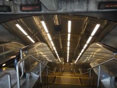
Don't stand too close to those steps: it's a long way down, about 100 feet to be precise. The Roosevelt Island Subway Statin is one of the newest in the system and also one of the deepest (that's almost 10 stories!). Although slated to open in 1979, the station finally opened to service in 1989. Well, you can't rush greatness. The design is the station quite different from almost every other station in the system: it has a mezzanine level, 3 escalators, vaulted ceilings, and concave walls. Rather than the traditional thick glass, white subway tiles, the Roosevelt Island Station is decorated with thin, grey tiles arranged in alternating patterns, and has a stainless steel robbed ceiling. It’s pretty futuristic!

The station is served by the F train at all times, which can take a passenger all the way to Prospect Park in Brooklyn in 37 minutes and to Washington Square Park in only 14 minutes!

Click here to see the upcoming schedule of trains, and maybe grab a cup of coffee and some free WiFi at the coffee shop next door.

Historical tour image: Blackwell House

North route · stop 4

Blackwell House

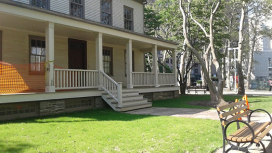
Now, we're sure you're asking yourself, what is a Colonial house doing in the middle of a bunch of apartment towers? Well, first of all, it's a Georgian house, not Colonial (we're not architecture snobs, we promise). Second of all, this house was here long before anything of the other buildings on the island, and is the first New York City Landmark on our tour.

Named after its original owner Jacob Blackwell, the Blackwell house was built between 1796 and 1804 as the main house on Blackwell's Island. After Blackwell's descendants sold the island to the City of New York in 1828, the house managed to survive as the warden's house of Blackwell Penitentiary. By the early 20th century, however, the house had fallen into severe disrepair; and by the time architect Georgio Cavaglieri had decided to landmark and restore the house in 1970, it was almost close to collapse.

Tragically, the original plan to transform the house into a teacher's headquarters and classrooms had to be scrapped after a fire gutted the restored house. The restoration was begun again and finally finished in 1976. Unfortunately, the house has never functioned as it was meant to, but there's hope: with help from the city's Municipal Art Commission, a grant has been awarded to remodel the interior of the house to make it a community center, with room on the second and third floors for the Roosevelt Island Historical Society and their archives. When we open you should stop in and say hello!

Check out the Blackwell's New York City Landmark Designation here to see why it's so special.

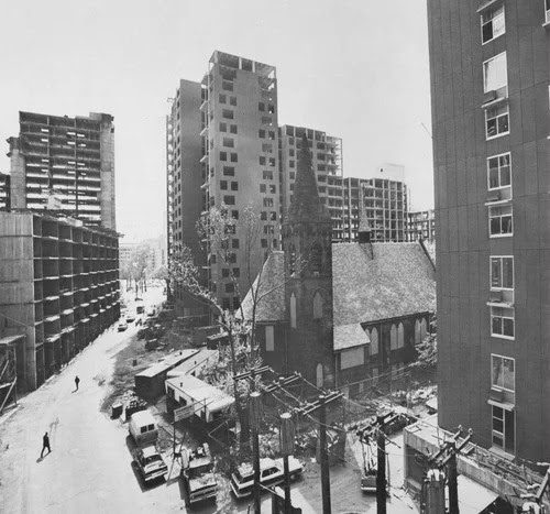
Roosevelt Island's first residential buildings under construction, with the Chapel of the Good Shepherd at center.

North route · stop 5

UDC Housing

Some locals call it East Berlin, but we think that's a bit harsh. Known as the WIRE buildings, (Westview, Island House, Riverwalk, and Eastwood) these four buildings are only residential buildings built following the Urban Development Corporation plan designed by Philip Johnson and John Burgee. For you architecture buffs, the architects of these buildings are quite famous, and include Sert, Jackson & Associates (Westview & Eastwood). Johansen & Bhavani (Rivercross & Island House).

All four buildings were built under the Mitchell-Lama Housing Program, which developed and built affordable housing, both rental and co-operatively owned, for low and middle-income residents.

Completed in 1975 and 1976, respectively, the buildings were designed in a brutalist aesthetic that some people (no judgement) find hard to love. One of the important features of the WIRE housing buildings are the unique, modern, monolithic facades.

However, with ample-sized apartments, private pools and saunas, and open courtyards leading to the promenade, the amenities and location of these houses made them prime real estate when they were built that still holds true to this day.

The ground level of each building houses commercial space, including the Roosevelt Island Branch of the New York Public Library and Coach Scott's Main Street Sweets , a perfect spot to enjoy an ice cream or iced coffee on a hot day.

Historical tour image: Chapel

North route · stop 6

Chapel

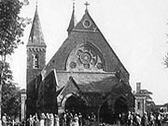
Wedged in between the WIRE buildings is another island landmark: the Chapel of the Good Shepherd. Built in 1889 by English architect Frederick Clarke Withers (the same Withers responsible for Jefferson Market Courthouse), the chapel seated 400 worshipers from the nearby almshouses, while the lower level was the island's first library.

When the almshouses were demolished and the two new hospital complexes built their own chapels, the gothic revival structure fell into disuse. It was only in 1970 that Georgio Cavaglieri, who had already completed the restoration of Jefferson Market Courthouse in the West Village, selected the chapel to be one of 6 structures to be saved and restored under the Johnson Burgee development plan.

The Chapel was reopened in 1975 as the Chapel of the Good Shepherd Ecumenical Community Center, which it is still used for today. The slate roof of this chapel was also restored in the last few years. It is one of two slate roofs on the Island. The Good Shepherd Plaza that surrounds the chapel is a perfect place to relax and read, as it is almost directly across from the NYPL. In case you didn’t know, you can take out a book at the Island's branch and return it at any Manhattan, Staten Island, or Bronx branch; so don't be afraid to take a little bit of Roosevelt Island with you!

Check out the Chapel of the Good Shepherd's New York City Landmark Designation here to see why it's so special.

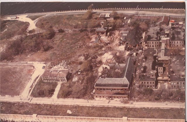
A 1968 aerial view of the area that would become PS/IS 217 and Westview.

North route · stop 7

Schools

Is this another high-tech residential complex? Nope! This 93,000 square foot complex, designed by famed architect Michael Fieldman and Partners in 1992, is Roosevelt Island's only school. Although the Johnson-Burgee plan called for a multitude of mini schools, of which five were actually built, the construction of Manhattan Park, which is up next on the tour, prompted the construction of a complex better able to handle the influx of students.

Built in similar design to the subway stop and Motorgate, which is also coming up, the school has clean lines peppered with flashes of RIOC Red, like many other things on the island. The school has a two-story gym, a fine arts wing, and a cafeteria with waterfront views. Sorry adults on the tour, the school only serves grades Pre-K to 8, but those wishing to enroll should check out the school's website here .

Opposite the school is the Roosevelt Island Bridge, painted in, you guessed it, RIOC Red. Opened on May 18, 1955, the RI Bridge replaced the vehicular elevator on the Queensboro Bridge, and is still the only avenue for vehicular traffic to reach the island. The bridge is a vertical drawbridge, lifting the entire 418 foot span up and back down as ships pass underneath. The bridge doesn't see much traffic until the Fall, when the UN Summit closes the west channel of the East River to traffic. There is also a pedestrian and bike path, and the Q102 Bus uses the bridge to pick up passengers traveling to and from Queens. A copy of the bus schedule can be found here .

Happy Travels!

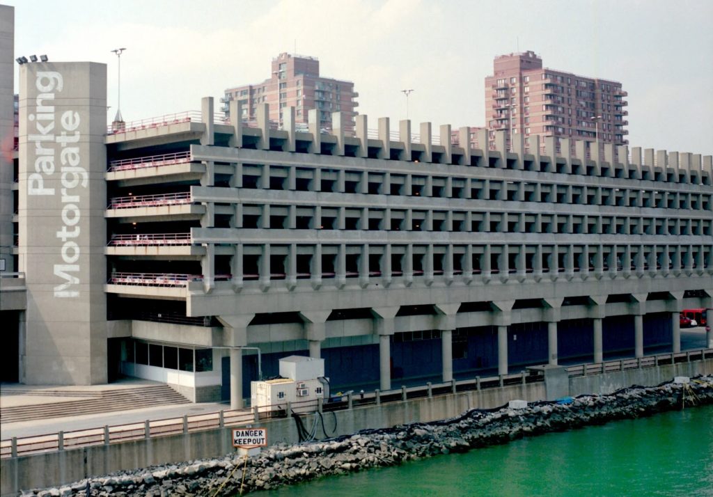
Motorgate parking garage photographed from the East River.

North route · stop 8

Motorgate

Although it looks imposing from the outside, Motorgate is at its most basic a parking garage. But don't let its primary function fool you. Motorgate is also the entryway for many visitors from Queens and those who drive in from Manhattan. Designed by Kalmann & McKinnell and completed in 1974, Motorgate once held the dubious distinction of using the most concrete in a single project. With an original capacity of 1,000 cars, Motorgate can now hold almost 2,000 cars.

Why such a big parking garage for such a small island? The Johnson Burgee plan designed the island to be car free. As you have seen on your tour, that is no longer the case. But that doesn't mean Motorgate is useless! The atrium is currently the home of a modern art exhibit, and it is still the entry and exit way for vehicles on the island. See if you can find the old trams laying around near the water.

Across the street is Manhattan Park, built in 1989 and designed by Gruzen, Sampton & Stenglass. 4 towers are market-rate housing, while the 5th serves lower-income residents. At the interior of the compex is the park of Manhattan Park, designed as a formal European-style green space with defined paths and planting beds.

Is this island growing on you yet? Why not see if some units are available ?

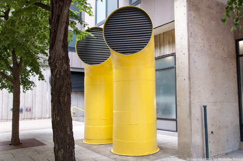
The yellow intake pipes of Roosevelt Island's automated vacuum waste collection system.

North route · stop 9

AVAC

Remember when "the future" meant that everything was going to travel around in tubes? Well, on Roosevelt Island, that's partially true. Refuse is collected from residents through an Automatic Vacuum Collection System, known as AVAC. Every hour, a computer opens valves in one of two massive pipes underneath the island that whisks trash to this central collection building at 55mph. Now that's some fast trash! Speaking of fast trash, have you seen the exhibit about this system called Fast Trash ?

The futuristic collection building was designed by Kalmann & McKinnell (remember them from Motorgate?) in 1975 and is especially streamlined to reflect the advanced technology it houses. Originally introduced in Sweden in 1961, Roosevelt Island's AVAC is one of only 6 systems built in the US (which includes the one in EPCOT), and is the only residential system. It is also the largest system in the US, able to handle the garbage from 20,000 households. What's even more amazing is that all of this operates completely out of sight. Now imagine what happens when this system gets blocked. Unfortunately it is the job of a very skinny man to crawl into a tube and fix everything. It’s a wonder that the system works so well, sight unseen. It's even operating right now, right under your feet!

Historical tour image: Gardens

North route · stop 10

Gardens

Depending on what time of the year it is, you might not even realize this is our next stop. If it's spring or summer, however, you know exactly where you are. This is the Roosevelt Island Community Gardens, divided into 200 individual plots where members of the Roosevelt Island Garden Club grow everything from local fruits and vegetables to exotic and rare flowers.

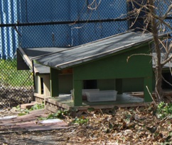
The garden's south east corner also acts as a shelter to the island's many outdoor cats proving them food water, and a place to lounge, rain or shine.

Interested in helping these cats or maybe even taking one home with you? Check out Island Cats for more information.

Historical tour image: Coler Hospital

North route · stop 11

Coler Hospital

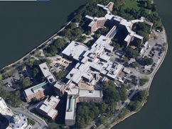
Completed in 1952, Bird S. Coler Memorial Hospital was, like its sister institution Goldwater Hospital on the island's south end, devoted to the treatment of chronic illnesses. Although perhaps not as architecturally interesting as Goldwater, Coler Hospital was just as dedicated to serving its community.

In 1996, the two institutions merged to form Coler-Goldwater Memorial Hospital focused on long-term patients, including para- and quadriplegics, and dementia and Alzheimer's patients. As of December 2013, The Coler Hospital campus is the only remaining campus in operation on the island.

Historical tour image: Octagon

North route · stop 12

Octagon

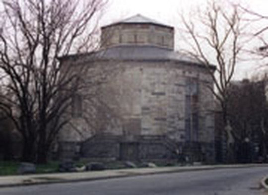
Nestled between two modern looking rectangular wings is the Octagon tower. Originally constructed in 1834 and designed by Alexander Jackson Davis, the 5-story rotunda of gneiss quarried from the island was originally the New York City Lunatic Asylum. Although the institution was meant to help New York City's most vulnerable, it seems that the institution was plagued with difficulties from the very beginning.

When Charles Dickens visited the Asylum in 1842, he wrote in American Notes that the place had a "lounging, listless, madhouse air." Abuse became so rampant that in 1887, reporter Nellie Bly went undercover as a patient at the asylum to report on the deteriorating conditions. Her book, Ten Days in a Madhouse became a best seller, and also led to patients being transferred to a more suitable facility on Ward's Island in 1894.

The buildings were later occupied by Metropolitan Hospital, which specialized in treating tuberculosis, and even operating a Leprosy Ward from 1902 to 1921. The Hospital moved to Harlem in 1955, and the campus was subsequently abandoned. Although the Octagon tower was landmarked by the city in 1976, it suffered form vandalism and several fires, the largest being in 1999, which effectively gutted the tower.

In 2006, the tower was completely renovated and two modern wings were added, creating a 500 unit market-rate housing complex. You don't have to be crazy to get a room in here anymore, but you do have to be competitive. See for yourself . Apparently everyone is a little nuts when it comes to the Octagon.

See if you can find the sculpture of Sabrina, nearby the Octagon. Sabrina is also the patron goddess of Amherst College. A metal casting of her, made by the J.L. Mott Iron Works of New York City, was given to the college by Massachusetts Lieut. Governor Joel Hayden in 1957. The statue was located adjacent to The Octagon building on the Amherst campus until 1885. Roosevelt Island's installation re-establishes the historic setting of Sabrina adjacent to an Octagonal building.

Check out the Octagon's Designation Report here and see why we're just as crazy about it!

Historical tour image: Dayspring Church

North route · stop 13

Dayspring Church

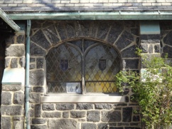
Greenery and the Octagon development both dwarf this tiny gneiss, a type of stone, chapel, originally constructed in 1924 as the Episcopal Chapel of the Holy Spirit, for the former Metropolitan Hospital. When the hospital moved to Harlem in 1955, the chapel was effectively abandoned, save for the hospital's chaplain, who liked his quarters in the chapel's rectory so much that he decided to stay until the 1990s.

The Chapel is currently home to Dayspring Baptist Church, and although the building is in use, many of its original stained glass windows are cracked or broken, and several highly noticeable alterations have been made (check out the back door).

The rear yard of the chapel is home to another cat sanctuary, whose occupants seem quite content to lay in the shade of the little sanctuary.

Interested in protecting the chapel? Fill out a nomination form. (Psst...the Address is 851 Main Street, New York, NY 10044, Block 1373, Lot 1.)

Historical tour image: Promenade

North route · stop 14

Promenade

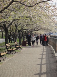
This promenade is perhaps the most successful and most beloved element of the 1969 Johnson Burgee plan. It is accessible to all residents, including residents of the Coler campus directly to your right. A round trip along the promenade is about 4 miles; enough to burn off that ice cream you had on Main Street.

As you walk north on the promenade, look to your left for a completely unique view of Manhattan's Upper East Side. As cars speed up and down the FDR, the Circle Line Cruise ships battle the current upward towards the Bronx, you can also see Carl Schurz Park built on a deck above the FDR.

In the distance to the northeast is the Robert F. Kennedy Bridge and Ward's Island straight ahead, where many of Roosevelt Island's undesirable inhabitants were sent. But just because they've gone, doesn't mean they're forgotten. Our last stop on this tour shows just that.

Historical tour image: Lighthouse

North route · stop 15

Lighthouse

This 50 foot tall octagonal tower and the park named for it compose the very northern tip of Roosevelt Island. It was designed by James Renwick, Jr. in gothic revival style in 1872, and it was used to help ships navigate the treacherous currents of Hell Gate. But, there is a far more interesting legend concerning the Lighthouse than just a commission by the city.

Two inmates from the Lunatic Asylum, John McCarthy and Thomas Maxley, have both been credited with building the tower. Fearing a British invasion, McCarthy built a four foot high mud fort, effectively filling in marshland that would become Lighthouse Park. Maxley has also been credited with building the lighthouse by following or modifying Renwick's design. Until the late 1960s, an inscribed stone by the lighthouse read:

"This is the work

Was done by

John McCarthy

Who built the Light

House from the bottom to the

Top All ye who do pass by may

Pray for his soul when he dies."

The Lighthouse remained in operation as a navigational aid until 1940, and can be seen in an early FILM by Thomas Edison from 1903. In 1970, the lighthouse was selected by Georgio Cavaglieri to be one of the island's preserved structures. It was added to the National Register of Historic Places in 1972, and declared a New York City Landmark in 1976. Through an anonymous donation of $120,000 dollars in 1998, the Lighthouse was completely restored, including interior lighting. Unfortunately, due to severe weather, including Hurricane Sandy, the Lighthouse is in need of a new roof. If you would like to help to replace the roof, please contact the Roosevelt Island Historical Society and let them know you'd like to help repair the Lighthouse.

Check out the Lighthouse's designation report from 1976 and see how interesting this lighthouse really is.

We really appreciate you taking this tour with us. Thank you for letting us share this amazing island with you. There is much more to see than what we have shown you today. If you haven't taken the Southern Tour, that is a great place to start. The Event Calendar lists many of upcoming celebrations and activities on Roosevelt Island. Why not frequent the stores on Main Street? Or invite someone on picnic to Lighthouse Park? The history of Roosevelt Island has already been established. How we remember and celebrate it depends on you.